Overview. This was the longest day in terms of driving and sightseeing. We took route 1 southeast to Vik, visiting along the way the Keldur turf house (the longest detour we had), Selljalandfoss and nearby waterfalls, Skagafoss, the Dyrholaey peninsula, and the nearby black sand beach Reynisfjara. We saw a lot of other things we could have done, had the day included double the hours: the hike to the crashed plane, a trip to a glacier, and an opportunity to visit a hot spring pool chief among them.
Weather. Hard to call it a bad weather day, but we've certainly seen better. Reykjavik and the vicinity started with grey skies, and the sun did not show up until afternoon, and even then, largely hid itself behind the clouds. This affected photography in a few places. Temperature was stable 14-15 degrees Celcius throughout the trip, with only Dyrholaey, with its harsh wind making us feel cold.
Keldur. This was a late addition to the itinerary. I got inspired to check reconstructions of Viking longhouses. Found one in
Stong Valley, but it was about an hour detour each way.
Keldur - which is not a reconstruction, but a real farmer's turfhouse lived in and maintained until 1946, when it became a museum, was much closer.
We left around 9:50, and had to get gas along the way, so, we got to Keldur close to noon.
 |
| Panorama of Keldur, including the turf house, the church, the river and Mount Hekla covered in clouds. |
There is a tour that lasts around 50 minutes, the three of us took it (the older one sat out) after a short wait.
 |
| Keldur. The turf house part of the farmhouse. |
The tour includes the building which consists of the old, turf house part with three rooms: pantry, sleeping room (former sauna), and the main room; and the newer annex made out of wood, that contains three more rooms downstairs (formal living room, guest bedroom and workers' bedroom) and a large bedroom upstairs, designed to house more than ten people, and used for everything from sleeping to working. There is also a newer attic in the turf house that can be seen from one spot in the tour, but it was used for storage, not living.
 |
| Keldur. In the pantry. |
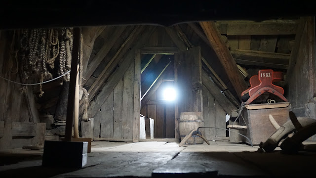 |
| Keldur. The turf house attic. |
 |
| Keldur. The secret passage to the river from the main room of the turf house. |
 |
| Keldur. Formal living room in the new (wooden) part of the farmhouse. |
 |
| Keldur. Back room (workers room) in the new part of the farmhouse. |
 |
| Keldur. Part of the upstairs bedroom in the new farmhouse. |
Turf houses are an interesting phenomenon, quite unique. At the same time the guide's description of the difficulties of living in harsh Icelandic climate, and the general "civilization did not come here until very recently" gist of his conversation reminded us a lot of life in rural Russia, which sometimes, even these days, involves pretty much the same sorts of challenges the Icelanders experienced.
 |
| Keldur. View across the river. The sheep shack. |
Seljalandfoss. From Keldur we drove to
Seljalandfoss - which is just off route 1 and is perfectly visible from a few kilometers away. Unlike Keldur, where there were maybe 10 people at a time,
Selljalandfoss is a huge attraction, with a large and completely full parking lot, and a campground for overnighters. The waterfall itself has one big defining feature - you can walk behind it and circle it 360 degrees.
We did what everyone else does and walked around the waterfall. It was very wet (raincoat is pretty much a must), but offered a really cool set of views of the fall.
First, here is the straight up view.
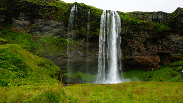 |
Seljalandfoss. View from the bridge across the river it is feeding.
|
Here is the view as one gets approaching from the parking lot.
 |
| Seljalandfoss. Approaching from the parking lot. |
A three-quarters view as the trail around the waterfall starts.
 |
| Seljalandfoss. The 4:30 view. |
The sideways view looking (roughly) north.
 |
| Seljalandfoss. The 3:00 view. |
Now, we are starting to move behind the waterfall.
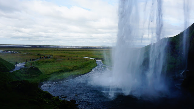 |
| Seljalandfoss. The 1:30 view. |
Finally, we are fully behind the waterfall. At this point, everything that can be wet is wet, the water dust is everywhere, and I had to wipe the camera lens after every series of shots I took.
 |
| Seljalandfoss. View from behind (12:00). |
We are now moving from behind the waterfall, and are facing (roughly) South.
 |
| Selljalandfoss. 9:00 view (looking south). |
A little bit further out, and here is the "Yep, I was there" shot.
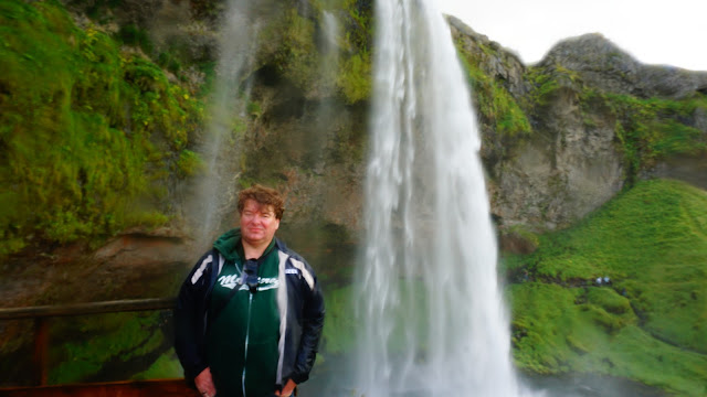 |
| Seljalandfoss. 8:00 view. Yep. I was there. |
And, one last shot to complete the loop, from the outbound trail.
 |
| Seljalandfoss. 7:00 view. |
After Selljalandfoss, the kids went back towards the parking lot, while Olga and I went a bit further along the cliff face. There are some secondary waterfalls there, but the real gem is hidden behind the camping ground.
 |
| Following the trail north of Seljalandfoss. A few secondary waterfalls can be seen. Here is one. |
One more waterfall,
Gljufrabui, is hidden behind a large rock (which also has a name that escapes me at the moment). Its top is visible from the path, just like this:
 |
| Gljufrabui, outside view. |
But the fun part is to follow the shallow riverbed (there is a path of stones and boulders barely clearing the surface of the river) around the rock to get behind it, where a round clearing about 20 meters in diameter serves as the landing for the waterfall.
 |
| Gljufrabui: the insider's view. |
The view from there is quite spectacular, despite wet. With no sun around, and with a half-naked dude running around the riverbed right under the waterfall and waving his arms, good pictures did not happen, but the ones I have give some impression of what it was.
 |
| Gljufrabui: I was there (right before being photobombed by a half-naked dude). |
Skagafoss. Just down the road from Seljanlandfoss is Skagafoss - also visible from the road. The parking lot was even more crowded than at Seljalandfoss - next to Skagafoss is a small tourist village full of hotels, hostels, and tourist amenities.
 |
| Skogafoss: approaching from the parking lot. |
The waterfall is quite powerful generating a lot of mist at the bottom.
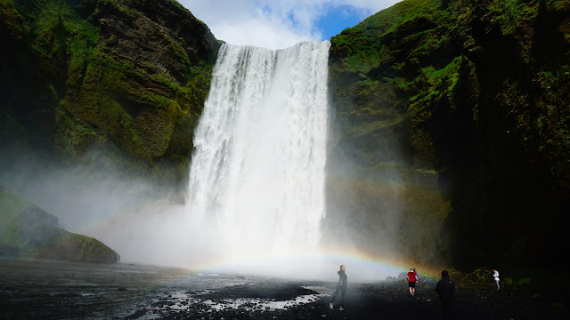 |
| Skogafoss. A rainbow underneath. |
 |
| Skogafoss. Full power. |
In addition to gettting to the very bottom of the fall we also hiked up the 400 step ladder leading to the top of the cliff, and went up the river for about a kilometer.
 |
| Skogafoss. View from the top. |
 |
| Skogafoss. It's a long way down. |
There is a secondary waterfall there, and the views of the high valleys and meadows are beautiful. The sun was the most visible during this part of the day, making West-facing pictures somewhat complicated.
 |
| The waterfall upstream of Skogafoss. |
 |
| The river, as it approaches Skogafoss. |
Dyrholaey. The Dyrholaey penninsula - or rock - is a 30 minute drive away from Skagafoss. Google maps turned us in the wrong place, but once we recovered, we arrived to the parking lot for the Dyrholaey overlook. We spent some time there taking pictures and viewing the scenery.
 |
| Dyrholaey - the best view I could get in this weather. |
I have a theory that every country with a coastline has its own Cliffs of Moher. We've been to the Portuguese and Australian versions, and Montana De Oro qualifies as a California version. Dyrholaey is the Icland's answer to Cliffs of Moher - with rock structures in the water, and a beautiful (although hard to see from the overlook) natural arch.
 |
| Panoramic view of Dyrholaey and the rock formations around it. |
 |
| Looking in the other direction (south-east) at the Reynisfjara black sand beach and the Reynisdrangar rock formations. |
Puffins. The Reynisfjara black sand beach is on the other side of the overlook, and as we approached it, there in the crack of the cliffs... there were two puffins! Yay! One more box checked, we saw the puffins. I chose this particular stop to get our binoculars out of the car, so Olga and the kids got a good close look at them. I took a few pictures with the biggest zoom I had.
The black sand beach, btw, is also quite stunning.
 |
| Reynisfjara black sand beach. |
Vik. From there, it was a short 17 km drive to Vik - largely a detour, the Dyrholaey observation point is 3.5 miles away from Vik as the crow flies.
 |
| Vik. The church on a hill. |
In Vik, we stopped next to the shopping center, and had food. Mine was a lamb soup, which is Iclandic version of schti (Russian cabbage soup), flavored with lamb. The younger kid had lamb chops, which were also good.
 |
| Icelandic Lamb and Cabbage soup. |
From Vik, it was a 2.5 hour drive home. We were back around 9:30pm.
Driving. Around 400 km altogether.
Walking. Google fit says 12,491. The longest walk was at Skogafoss - with 400 steps up and down.


No comments:
Post a Comment